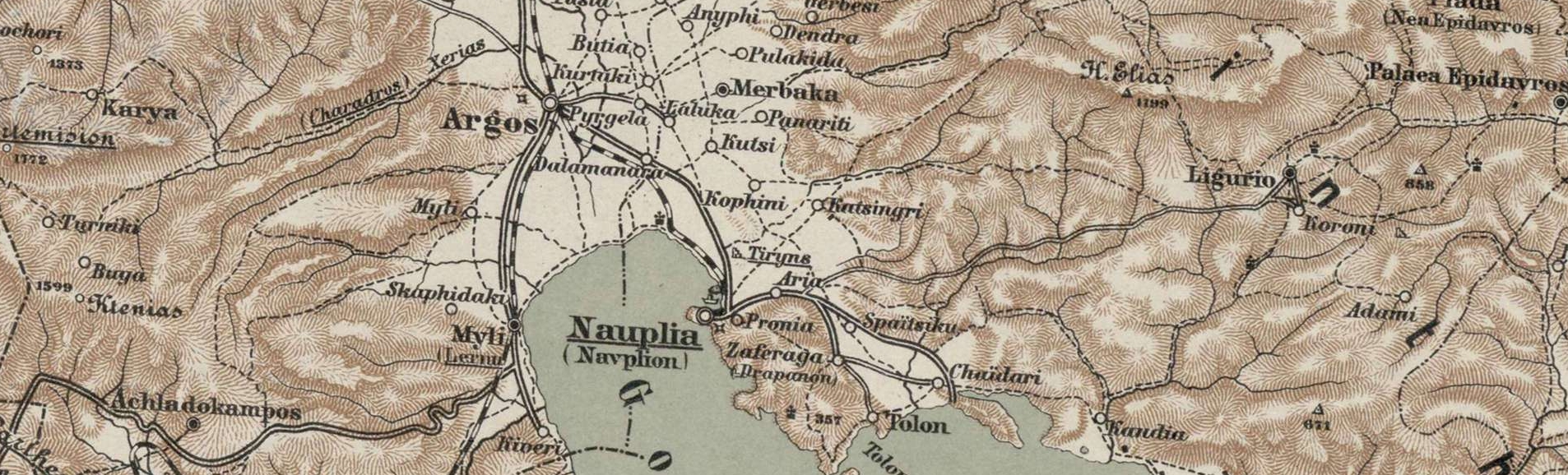

<h3 style="text-align: center;"><strong>Carte Des Côtes De La Grece depuis Navarin en Morée, jusqu'au Cap Doro au SE de Negrepont</strong> <strong>Avec la Partie de L'Archipel qui comprend Les Îles Cyclades.</strong></h3> <h3 style="text-align: center;"><strong>Dépôt général des cartes et plans de la marine et des colonies - 1797 - 1798</strong></h3> <h3 style="text-align: center;"><strong>Χάρτης των ακτών της Ελλάδας από το Ναυαρίνο στον Μορέα έως το ακρωτήριο Ντόρο ΝΑ της Εύβοιας</strong> <strong>Με Τμήμα του Αρχιπελάγους που περιλαμβάνει τις Κυκλάδες.</strong></h3> <h3 style="text-align: center;"><strong>Γενικό αποθετήριο ναυτικών και αποικιακών χαρτών και σχεδίων - 1797 - 1798</strong></h3> <p style="text-align: center;"><strong>Ναυτικός χάρτης, Παρίσι</strong></p> <a href="https://www.cityofnafplio.com/wp-content/uploads/2022/06/Image-38-ink.jpeg"><img class="aligncenter wp-image-11962" src="https://www.cityofnafplio.com/wp-content/uploads/2022/06/Image-38-ink.jpeg" alt="" width="800" height="529" /></a> <a href="https://www.cityofnafplio.com/wp-content/uploads/2022/06/Carte-Des-Côtes-De-La-Grece_1797-ink-min.jpeg"><img class="aligncenter size-full wp-image-11960" src="https://www.cityofnafplio.com/wp-content/uploads/2022/06/Carte-Des-Côtes-De-La-Grece_1797-ink-min.jpeg"
